

BROWNFIELD AND GREENFIELD MINING SCANNING
Brownfield Mining Scanning
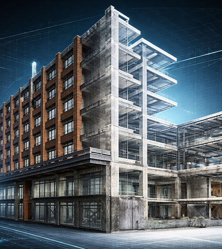
Brownfield projects involve existing mining sites or projects requiring maintenance, upgrades, or expansion. Our 3D scanning services capture precise as-built conditions, allowing your team to:By capturing every detail accurately, we enable efficient planning, safe upgrades, and seamless integration of new infrastructure without disrupting ongoing projects.
Verification of existing conditions for renovation & retrofit projects.
Reliable spatial data for facility management & long-term operations.
Precise documentation for regulatory compliance and building permits.
Advanced clash detection and coordination for future design works.
Delivered construction record drawings for project handover and closeout.
What Is Brownfield Mining Scanning

Brownfield & Greenfield Mining Scanning
Brownfield mining projects involve existing operational sites where accurate documentation is critical before upgrades, expansions, or maintenance work begins.
Why Scan at Brownfield & Greenfield Mining Sites
Our scanning services capture real-world site conditions with millimetre-level accuracy, reducing clashes, downtime, and costly design errors.
Accurate digital records of existing infrastructure
Reduced shutdown and rework costs
Building permit applications and inspections.
Improved retrofit and expansion planning
Safer planning in complex operational environments

Purposing Of Scanning A Greenfield Mine Site
Greenfield projects involve new mining developments with no prior infrastructure. Our 3D scanning services help you
Survey terrain and geological formations with high precision
Model proposed CHPPs, conveyors, transfer chutes, hoppers, and structural elements
Plan layouts accurately for extraction, processing, and logistics
Support environmental and regulatory compliance through detailed site documentation
Benefits include
Accurate planning from the ground up
Reduced risk of unforeseen geological or operational challenges
Improved cost estimation, resource allocation, and project coordination
MINING INFRASTRUCTURE SCANNING
Applications of 3D Laser Scanning in Mining Projects
Who Benefits from Brownfield & Greenfield Mining Scanning and Documentation?
Brownfield and greenfield mining scanning is essential for engineers, surveyors, planners, and mining operators involved in site development, expansion, and infrastructure management. It provides highly accurate real-world data of mining environments, helping reduce risks, improve planning accuracy, support safer operations, ensure compliance, and enable informed decision-making throughout the entire mining project lifecycle.
Where Laser Scanning Adds Value On A Mine Site


Euler Engineering has provided as-built scanning services for a wide range of industries.
Agricultural Facilities
Architectural Documentation
Concrete Construction
Historical Documentation & Preservation
Construction
HVAC & MEP Coordination
Clash Detection
Mixed Reality & 3D Projection Mapping
Design Build
Office & Commercial Buildings
Energy & Utilities
Overhead Clearances
Engineering
Oil & Gas Facilities
Real Estate
Power Plants & Process Plants
Telecommunications
Stadiums, Arenas & Theatres
Schools & Universities
Virtual Design and Construction
Accident Reconstruction
Water & Wastewater Treatment Plants
OUR CASE STUDIES
Delivering Precision Across Every Project


